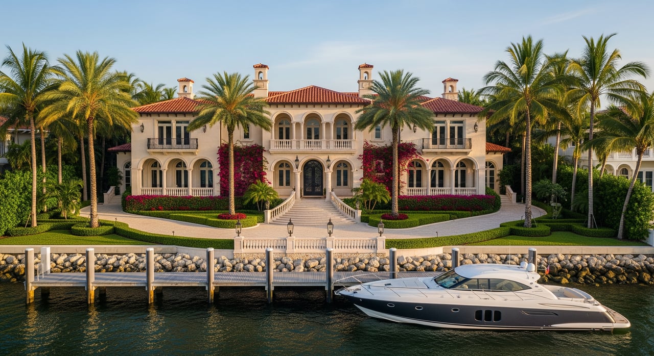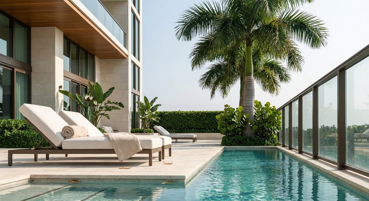
You can fall in love with the view in a second, but buying a waterfront lot on Indian Creek takes more than a dock dream and a survey. You’re investing on the edge of Biscayne Bay where seawalls, elevations, permits and biology shape what you can build and how fast you can do it. In this guide, you’ll learn the key checks that protect your timeline and budget, plus who reviews what and when. Let’s dive in.
Indian Creek essentials
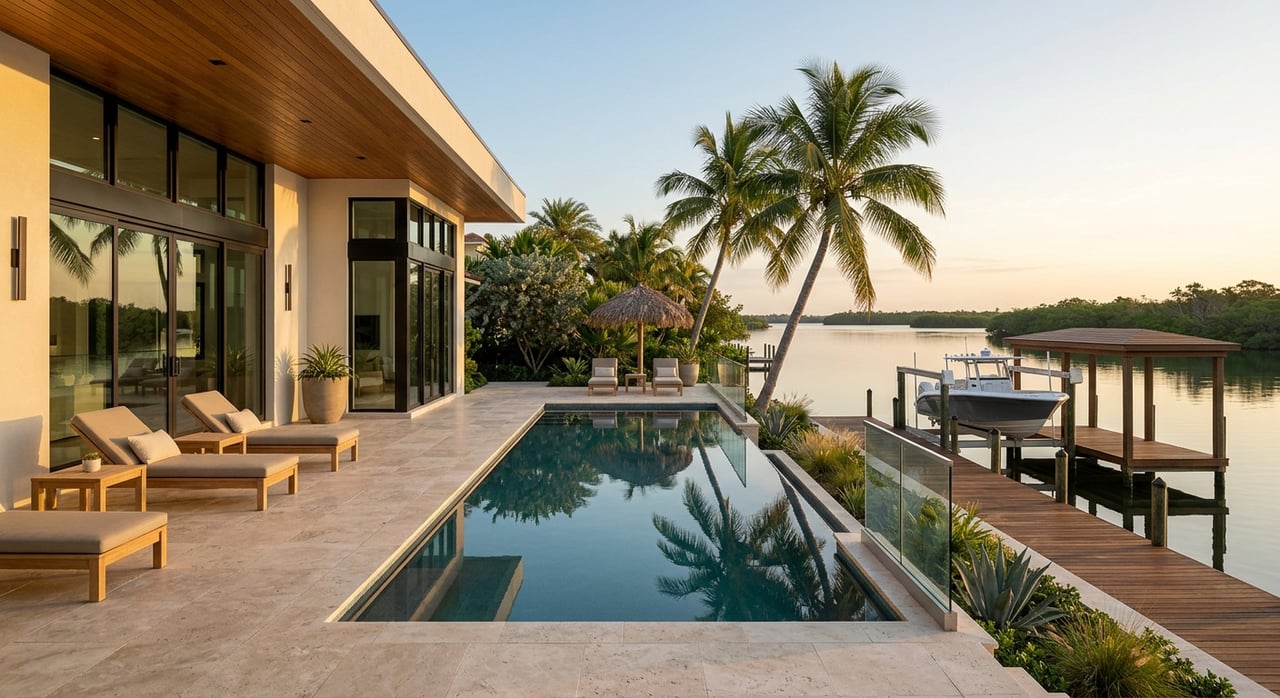
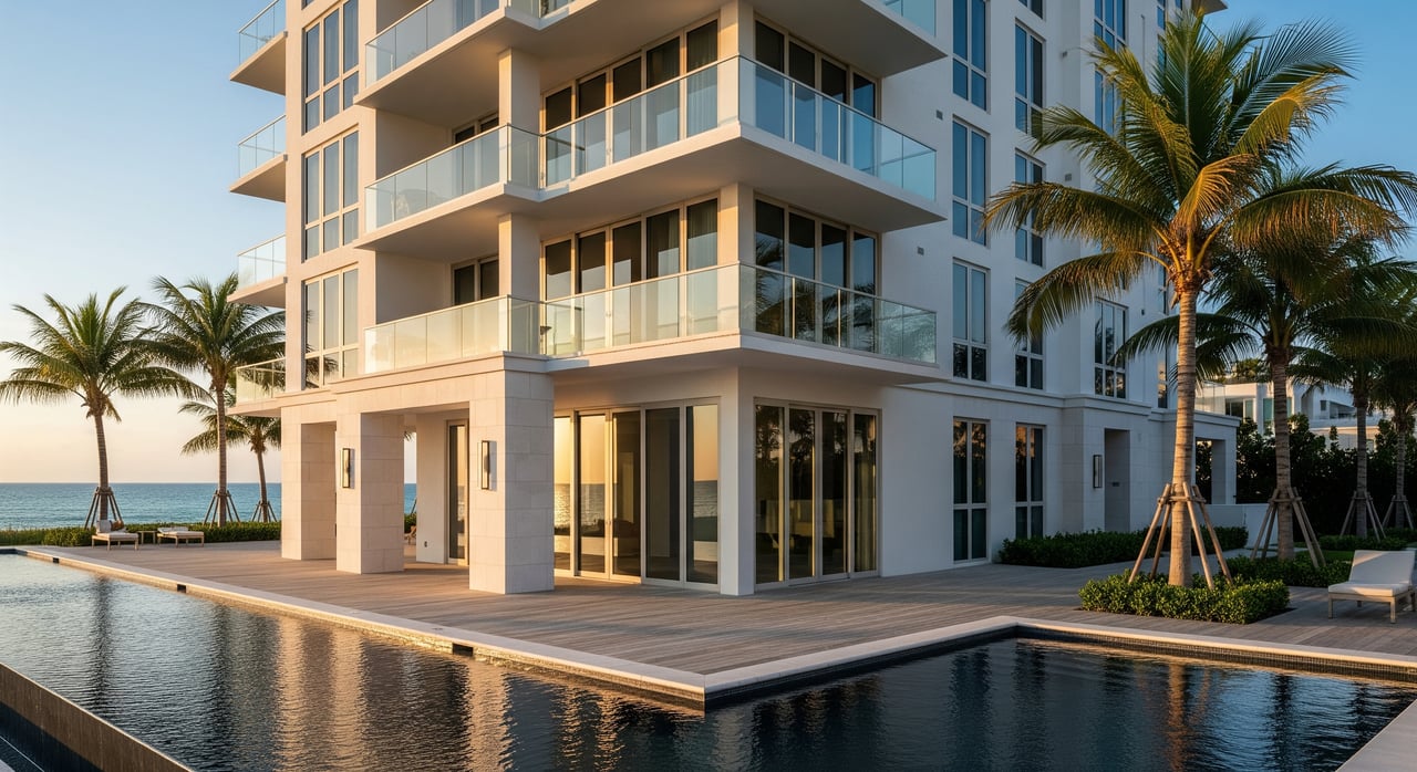
Indian Creek Village is a small, gated island in Biscayne Bay with only a handful of large waterfront parcels. The Village issues local building permits and coordinates inspections, so your first calls should verify deed restrictions, permit history and any local requirements beyond county rules. Start with the Village’s building department resources to confirm contacts and submittal needs.
Regional climate planning also matters for long-term value. Southeast Florida’s unified projection recommends planning for roughly 10 to 17 inches of sea-level rise by 2040 and 21 to 54 inches by 2070 compared to 2000 mean sea level. Use the Compact’s sea-level projection and NOAA’s Sea Level Rise Viewer to sense-check long-range assumptions for wall heights and site design.
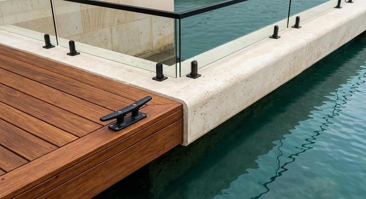
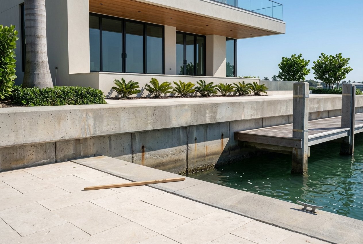
Start with the seawall
A seawall in poor condition can sink your project before it starts. Ask the seller for as-built drawings, original permits, repair records and any underwater photos or inspection reports. Miami-Dade’s seawall code and application packets typically require as-builts on repair or replacement, so early documents will save weeks later. For technical context and submittal expectations, review the county’s seawall ordinance file and process updates in the Miami-Dade code record.
Hire a marine structural engineer and a diver to evaluate the wall. You want eyes on pile corrosion, toe scour, undermining, tie-back failure, panel lean and joint separation. A geotechnical report with borings supports any major rehabilitation or replacement and is often listed in coastal permit packets, including the Florida DEP’s Coastal Construction Control Line forms.
Budget order-of-magnitude costs before you fall in love with a concept plan. Industry ranges for residential seawall replacement in Florida often run about $150 to $600 per linear foot depending on material, access and depth. That is construction only. Add engineering, permitting, potential mitigation and a smart contingency for underwater unknowns. See typical ranges in this industry cost overview.
Check elevation and flood risk
Confirm your flood zone and current Base Flood Elevation, then request any existing Elevation Certificate. If one is not available, plan to obtain an as-built survey tied to NAVD88. Insurance, lender underwriting and minimum finished-floor elevations all key off this data. Pull official maps and a parcel FIRMette from FEMA’s Flood Map Service Center.
Confirm habitat and bottom conditions
Indian Creek and Biscayne Bay frequently involve seagrass and other protected resources. If submerged vegetation lies within your project footprint, design changes or mitigation may be required, and in some cases denial is possible. Expect benthic and bathymetric surveys to be part of a complete packet. The UF/IFAS guide to coastal work outlines typical surveys and living shoreline options that can reduce impacts in suitable sites; it is a good primer on methods and permitting touchpoints. Review the UF/IFAS coastal guidance before you hire your team.
Permits and who reviews what
Waterfront work often touches several agencies. Coordinating early keeps you out of rework.
Local: Village of Indian Creek
The Village issues building permits for structures on the lot and coordinates inspections. Ask for the property’s municipal permit history and any recent inspection records. Confirm whether any local restrictions exceed county rules through the Village building department.
County: Miami-Dade environmental review
Miami-Dade is the central reviewer for many seawall and shoreline applications. Recent updates created clearer technical limits for short-form approvals, a Gold Key tracking system and a 90-day target for Class I decisions after the county issues a completeness summary. If your proposed seawall extends beyond delegated limits, the county will route you to state and federal review. Study the specifics in the county’s seawall permit ordinance file.
State: Florida DEP
Florida DEP handles Environmental Resource Permits and state-owned submerged lands authorizations for structures that extend over state bottomlands. While the CCCL program is more common on oceanfront sites, DEP’s packets and forms outline geotechnical, biological and elevation documentation that may be requested for coastal projects. Get familiar with DEP’s CCCL forms and guidance so your design team collects the right studies up front.
Federal: U.S. Army Corps of Engineers
Work affecting navigable waters or federally protected resources triggers federal review under Section 10 and Section 404. Many residential shoreline projects qualify for a Nationwide Permit or a State Programmatic General Permit, which is usually faster than an Individual Permit. Recent federal data show Nationwide Permit verifications averaging roughly 55 days for complete pre-construction notifications, with more complex cases taking longer. See the summary in the federal Nationwide Permits rulemaking record.
Realistic timelines to expect
Pre-application calls or meetings with Miami-Dade and DEP are wise and can usually be scheduled within a couple of weeks. Field surveys for boundary, bathymetry, benthic resources and geotechnical borings often take two to six weeks to schedule and complete. If your project qualifies for the county’s short-form Class I seawall path, the target decision is about 90 days after you receive a completeness summary. If DEP or the Corps is involved, add several months based on scope and biology windows. The county’s process and timing are outlined in the ordinance file, and survey timelines and methods are discussed in the UF/IFAS coastal guide.
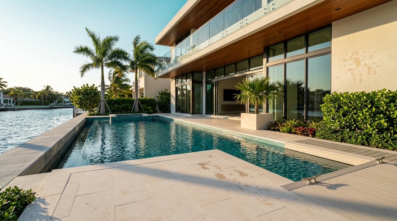
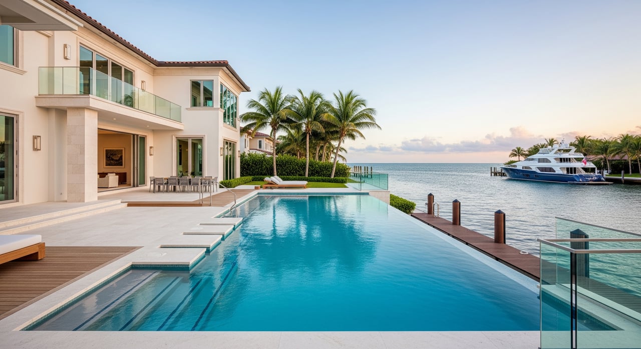
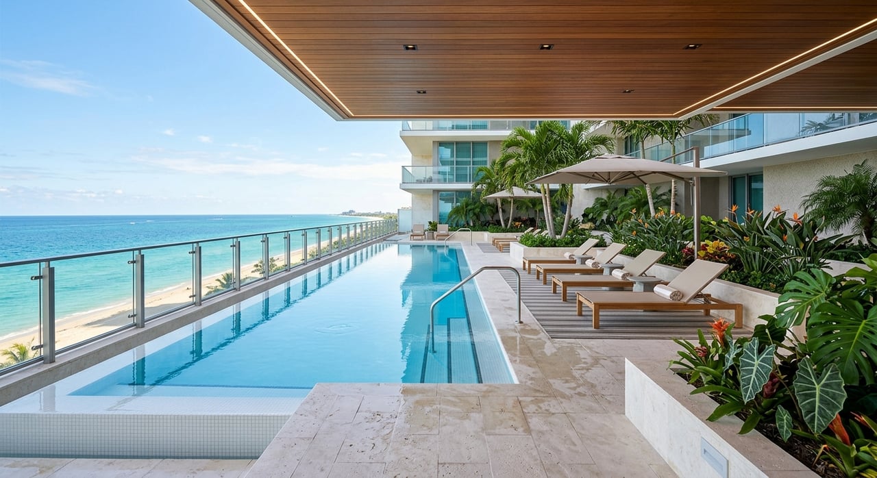
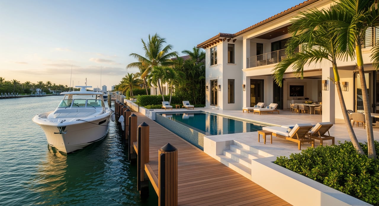
Dockage, navigation and riparian rights
A dock concept starts with water depth and safe maneuvering. Order recent bathymetric soundings to confirm your intended vessel’s length and draft will work without dredging. If dredging appears necessary, expect added permitting and potential mitigation. Submerged land ownership also matters. If any portion of your dock or piles will extend over state-owned bottomlands, you will likely need a state submerged-lands authorization in addition to DEP and Corps permits. A qualified surveyor and permitting consultant can map limits, and the UF/IFAS guidance explains how those surveys are used in applications.
Side yard setbacks and dock projection rules vary by jurisdiction. Do not assume another county’s standard applies. Verify Miami-Dade and Village standards during survey review and ask your title attorney to flag any recorded riparian easements or deed restrictions that could affect your layout.
Setbacks, orientation and site logistics
Request a current boundary survey with mean high water and mean low water delineations to confirm riparian lines and setback margins. Orientation matters too. Open bay exposure versus a more protected edge can change recommended wall height, armor type and the feasibility of hybrid living shoreline techniques. As you plan construction, consider site access and staging logistics. On narrow islands, crane placement, neighbor coordination and haul routes can add meaningful cost. DEP and county packets commonly request geotechnical data for coastal foundations, so schedule borings early.
A due-diligence checklist you can follow now
Work from a tight list so you do not miss a costly item.
- Boundary survey with mean high and low water lines and topography.
- FEMA FIRMette, current flood zone and any Elevation Certificate from the FEMA Map Service Center.
- Complete permit history and as-built drawings for seawall, docks and any dredging. Miami-Dade files and the county’s ordinance record provide process clues and conditions.
- Title search and recorded easements, including any riparian rights language and submerged-lands references.
- Underwater and structural seawall inspection by a marine engineer with diver video and a written repair versus replacement recommendation.
- Bathymetric and benthic surveys by qualified specialists to identify depth, seagrass and other resources. See survey expectations in the UF/IFAS coastal guide.
- Geotechnical borings and a soils report for wall and dock foundations; DEP’s CCCL documentation list shows typical geotechnical expectations for coastal work.
- Confirmation of submerged-lands status and any state lease needs if structures project over state bottomlands.
- Pre-application meeting notes with Miami-Dade and DEP to confirm the likely permit path and whether federal filings are expected.
- Early insurance quote based on current flood data for budgeting and lender alignment.
Budget and schedule expectations
- Permitting. If your seawall qualifies for Miami-Dade’s Class I short-form process, budget about 90 days after the county issues a completeness summary. When DEP and the Corps are involved, add months based on scope and biology timing. Federal Nationwide Permit verifications have recently averaged about 55 days for complete submittals, with complex projects taking longer. Reference the county’s process file and the federal NWP record as you plan.
- Construction. For seawall replacement, plan around $150 to $600 per linear foot in typical Florida residential ranges, then add engineering, permitting, potential mitigation and contingency. Get multiple bids once design is complete. See typical ranges in this industry cost summary.
Long-term value and resilience
Think in decades, not seasons. The regional projection for Southeast Florida suggests meaningful sea-level rise within common ownership horizons. Design choices like higher seawall elevations, hybrid living shoreline elements and documented submerged-lands authorizations can support smoother permitting and transferability later. Use the Compact’s sea-level projection and NOAA’s Sea Level Rise Viewer to test scenarios against your intended hold period and investment.
How we help you move with confidence
You should not have to manage a maze of surveys, engineers and agencies alone. With a concierge approach rooted in hospitality, we coordinate the right waterfront specialists, gather the documents that matter and keep your due diligence on schedule. Whether you are buying for personal use or as a long-term investment, you get a clear picture of what is feasible before you commit.
Looking at an Indian Creek lot or another premium bayfront site? Let’s align your goals, risk tolerance and timeline, then map the exact steps from survey to closing. Schedule a private conversation with Marine Rollins.
FAQs
What should I evaluate first on an Indian Creek waterfront lot?
- Start with the seawall’s condition, the property’s flood elevation data and any seagrass or habitat constraints that could limit design or timing.
Who issues permits for seawalls and docks in Indian Creek?
- The Village handles building permits, Miami-Dade reviews most shoreline work, Florida DEP authorizes state bottomlands, and the U.S. Army Corps reviews work in navigable waters.
How long do Indian Creek seawall permits usually take?
- County short-form decisions target about 90 days after a completeness summary, while state and federal involvement can extend the timeline by several months.
What surveys do I need before designing a dock on Biscayne Bay?
- You typically need a boundary survey with waterlines, bathymetric soundings, a benthic survey for seagrass or corals and geotechnical borings for foundations.
How much should I budget to replace a residential seawall in Miami-Dade?
- Industry ranges commonly run about $150 to $600 per linear foot for construction, plus engineering, permitting, mitigation if needed and contingency.
How does sea-level rise affect my Indian Creek lot planning?
- Use Southeast Florida’s projection to set a 30 to 50-year planning horizon and size seawall elevations and site design for higher future water levels.